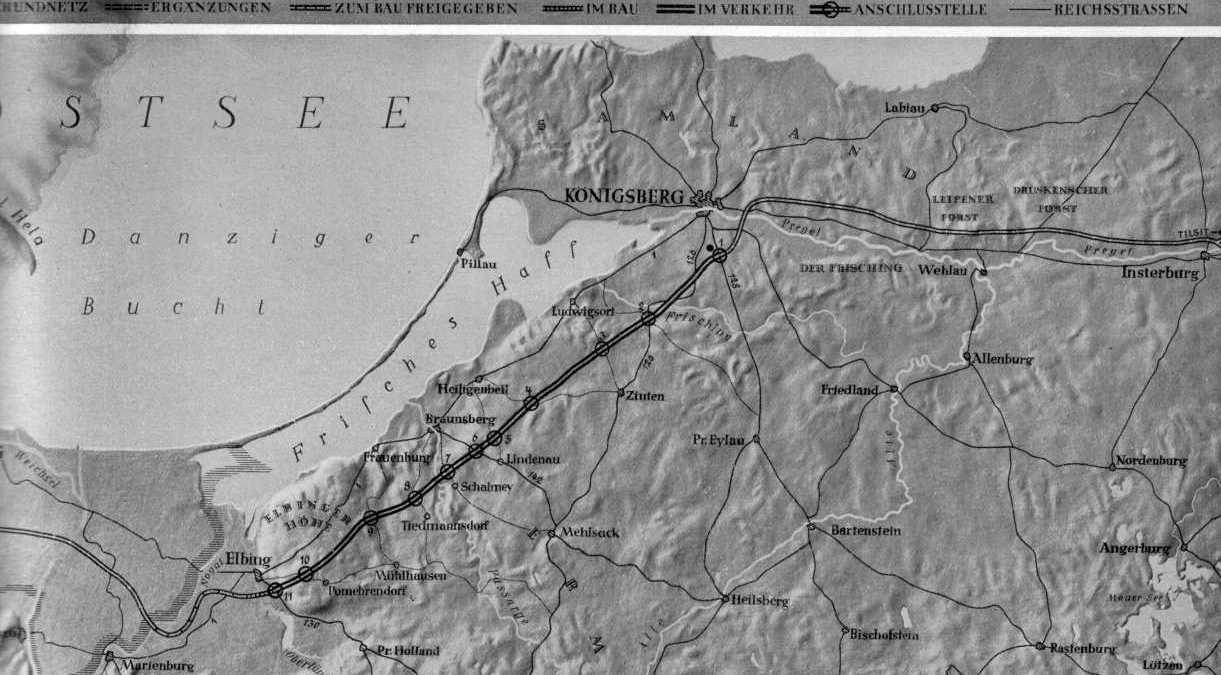
Mapa berlinki w Prusach z 1938 roku
Numery węzłów: 1 - Königsberg; 2 - Kreuzburg; 3 - Zinten; 4 Heiligenbeil Ost; 5 - Heiligenbeil; 6 - Braunsberg; 7 - Schalmey; 8 - Tiedmansdorf; 9 -Frauenburg; 10 - Pomehrendorf; 11- Elbing Ost.
Mapa pochodzi z książki: "Fünf Jahre Arbeit an den Straßen
Adolf Hitlers". Hrsg. vom Generalinspektor für das Deutsche Straßenwesen.
Berlin 1938.
Za udostępnienie dziękuję Cezarowi Bazydlo, autorowi strony o
Prusach http://www.geocities.com/jugendzeit_ostpr
.